Planned Estate Town – text by Paul Croghan
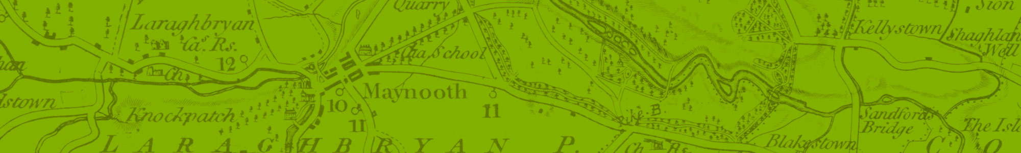
Main Street Maynooth (North East block)
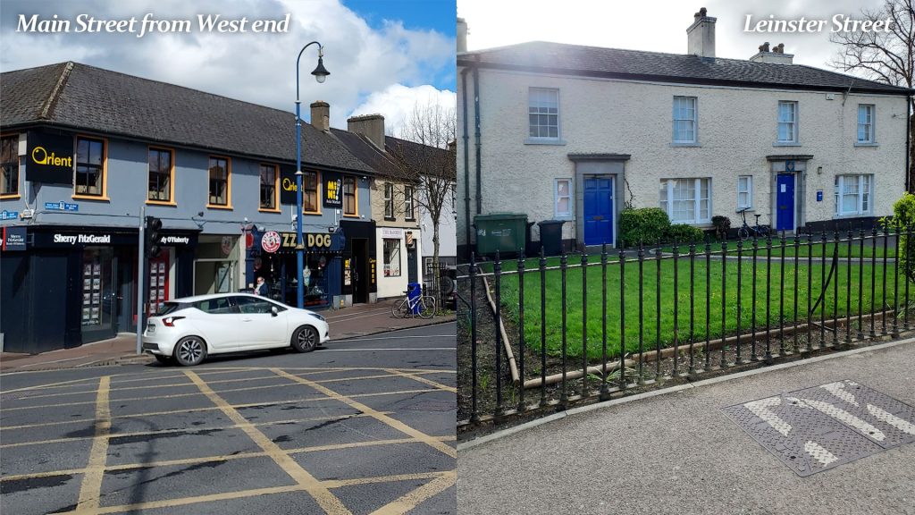
The 1757 Rocque map shows that the centre of Maynooth had developed in an disorganised way. At the western end of the village there were many buildings on the lands that would become St. Patrick’s College in 1795. Carton Avenue was already planted. The First Duke laid down the plans and began to develop the planned landlord village of Maynooth. This started with this row of houses which are two storey under a pitched roof. While they have been altered over the centuries mainly for commercial use, they are still essentially as they were built as three bay buildings today.
John Rocque map of 1757 shows the detail of the central part of Maynooth
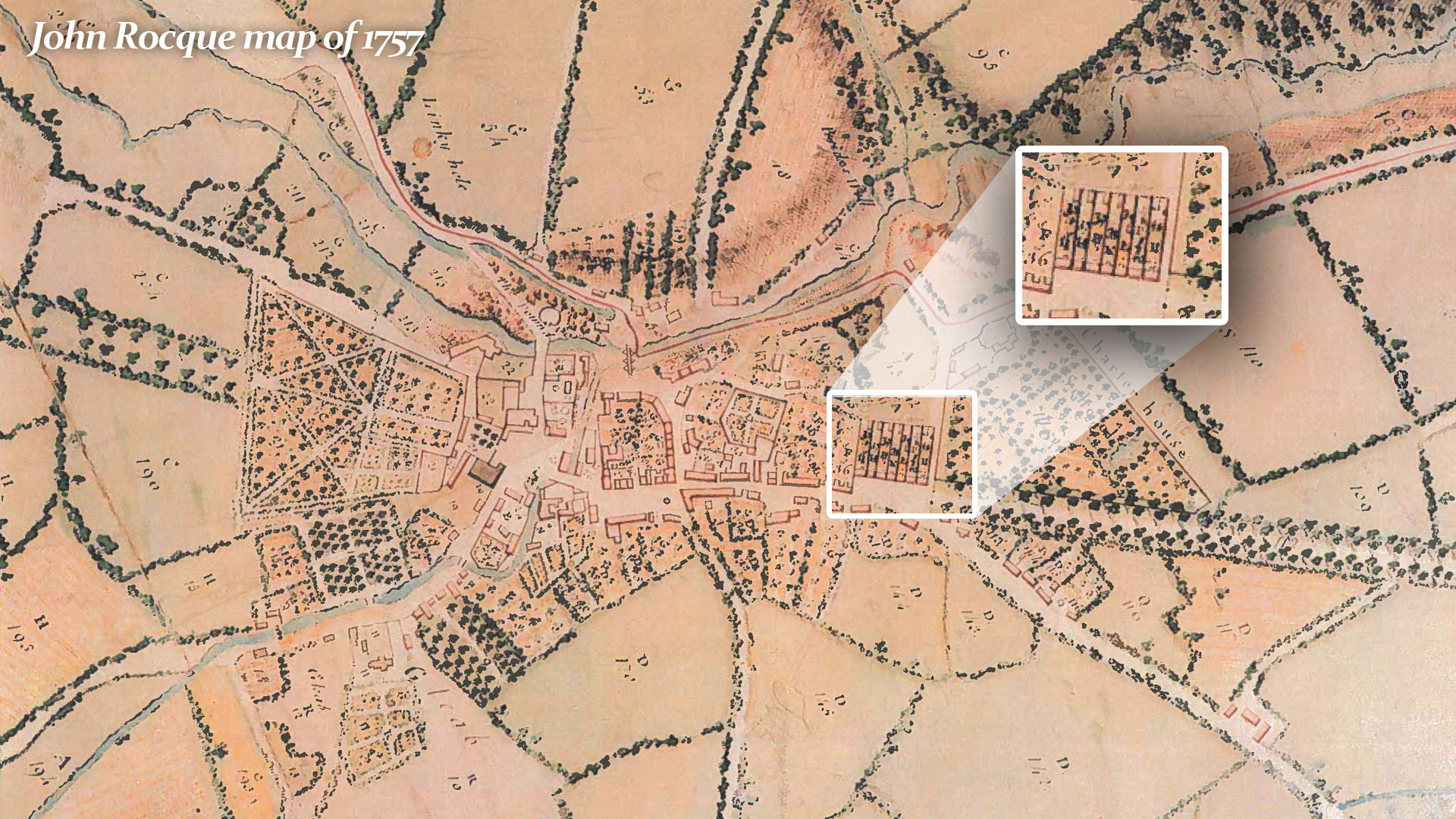
Nine houses in what seems like a single block can be identified on the north side of the eastern end of the Main Street.
Other Buildings recorded on the 1757 Rocque Map.
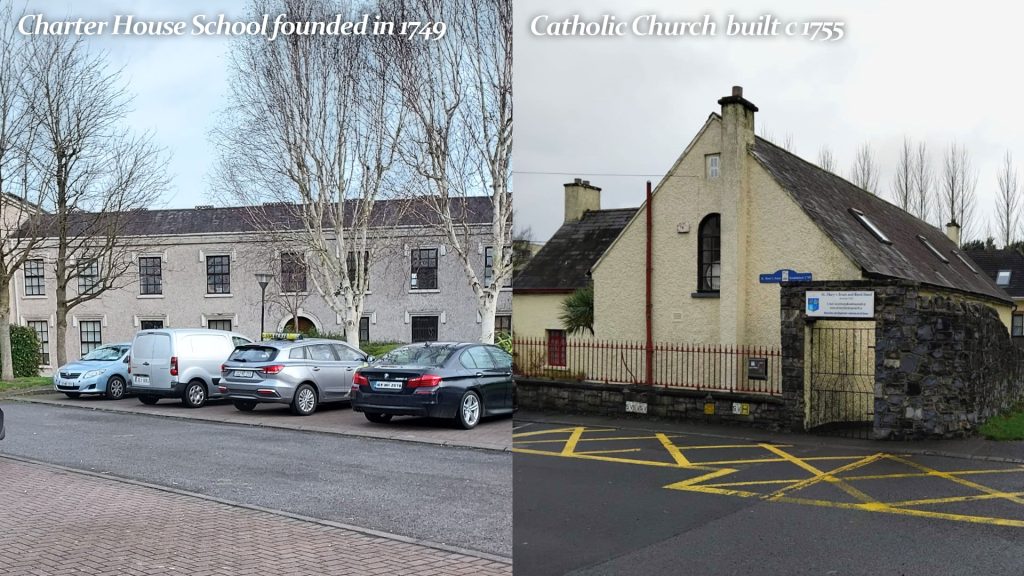
Originally a Catholic Church built c 1755 which was extended in 1840 to serve as a school until 1943 and now St. Mary’s Brass and Reed Band hall.
Originally a Charter House School founded in 1749 with the support of the 19th Earl. In 1823 the Presentation Sisters were invited there to open a convent and a school.
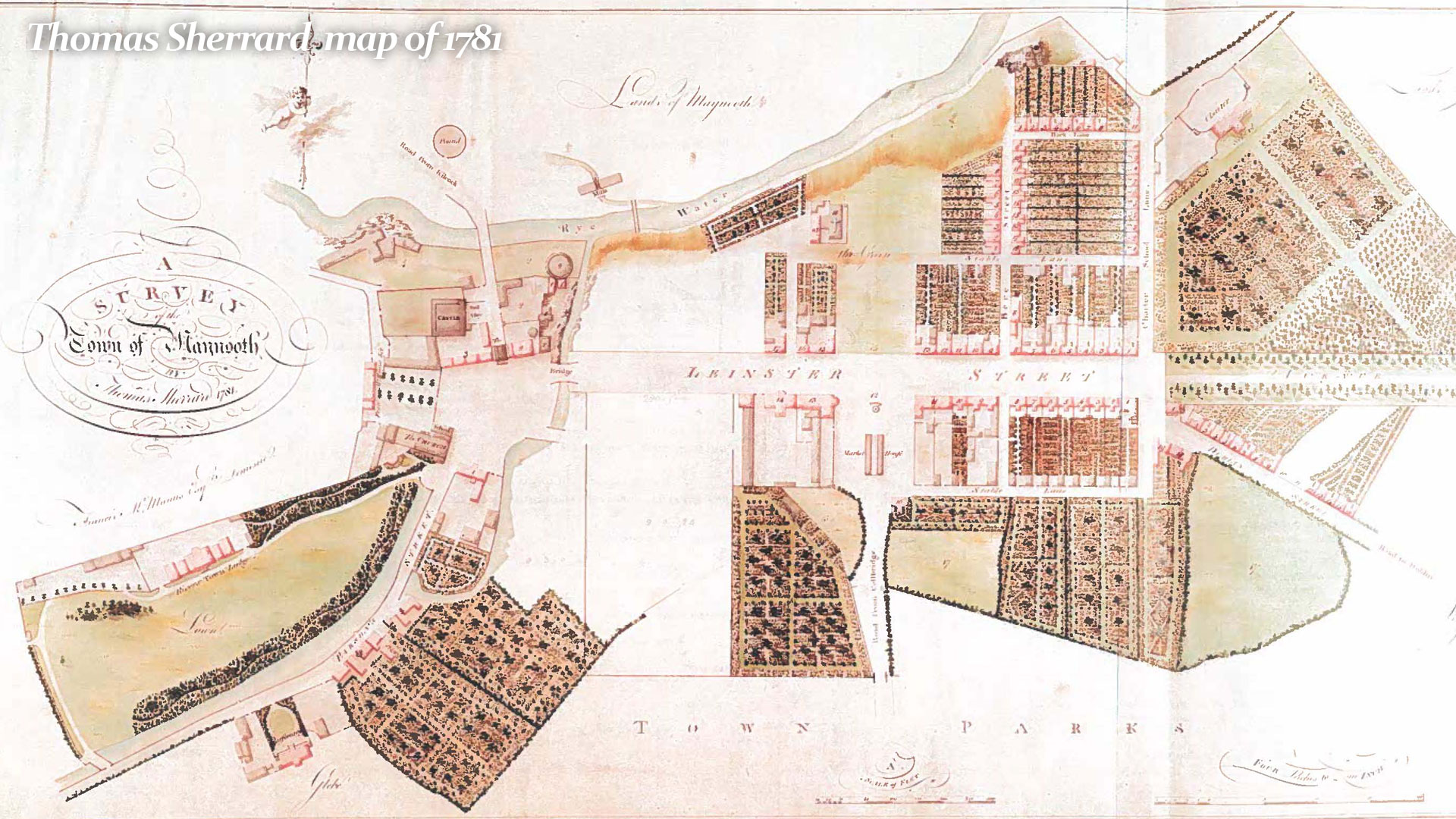
By 1781 much of the Eastern end of the village Centre is in place.
- The layout continues to be developed to the plan with the Duke providing leases
- A Peter Bere is responsible for much of this development
- Main Street is lined up between the Western end and Carton Avenue and is called Leinster Street at this time
- The south eastern side of the street is developed
- The estate cottages have also been developed much of which still survives
- Town Park is recorded on the map
- A Ballroom and Inn built 1777 is in place, later known as the Leinster Arms
- The Village Square and pumphouse is in place
- The Market House, later known as the Courthouse is recorded
Main Street Maynooth (South East block)
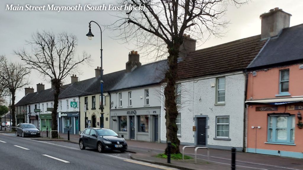
- Like the north side the buildings are two storey under pitched roof
- Buildings are three bay structures forming a terrace
- The 1781 map includes Stable Lane, Back Lane, Bere Street and Charter School Lane
- It shows the ten labourers cottages built on Charter House lane
- The wide Leinster Street is now created
1781 map drafted by Thomas Sherrard
Duke’s Plan continued – Two-storey under pitched roof
1821 Map by Sherrard, Brassington and Greene
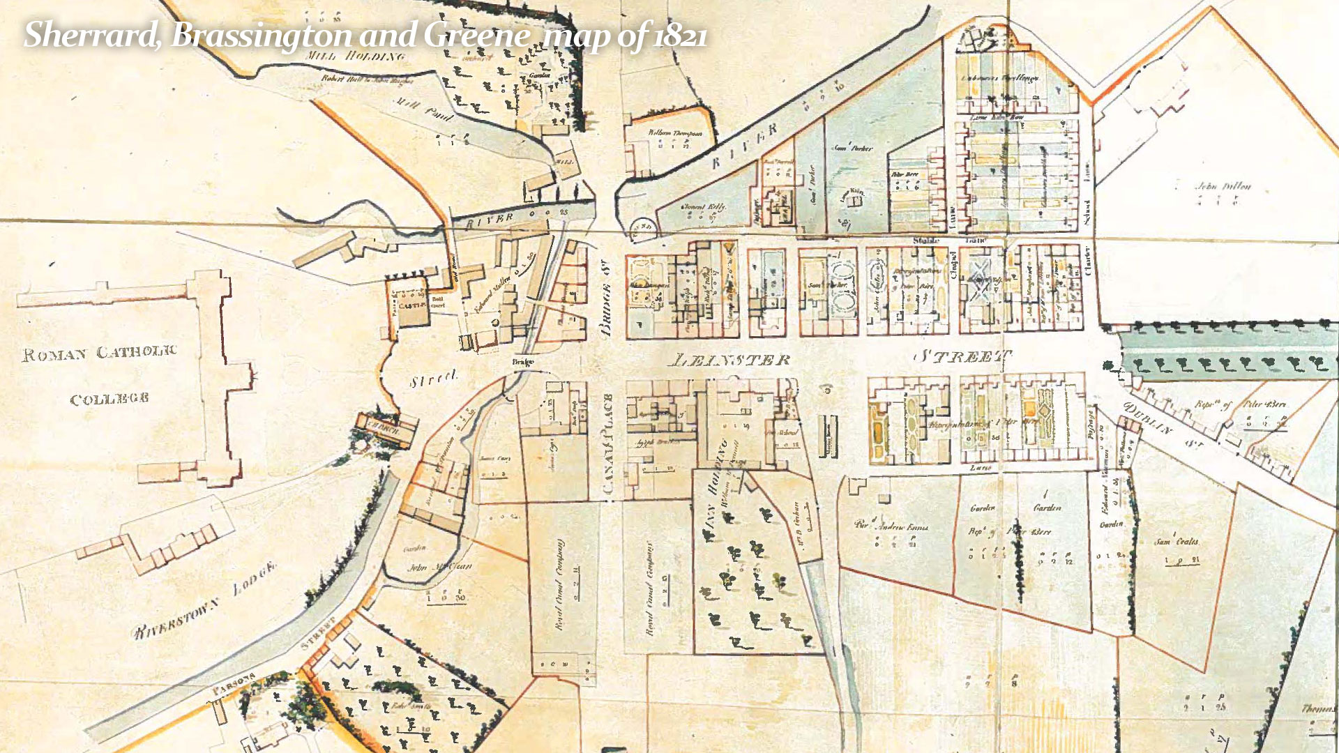
• Leinster Street was mainly completed by the 1790s
• In 1801, Mill Street was built with William Bridge crossing the river
• An improved link to the Harbour area (now Leinster Street)
• More businesses had been set up on Leinster Street (Main Street)
Maynooth Map circa 1837 – Irish Town Atlas (RIA)
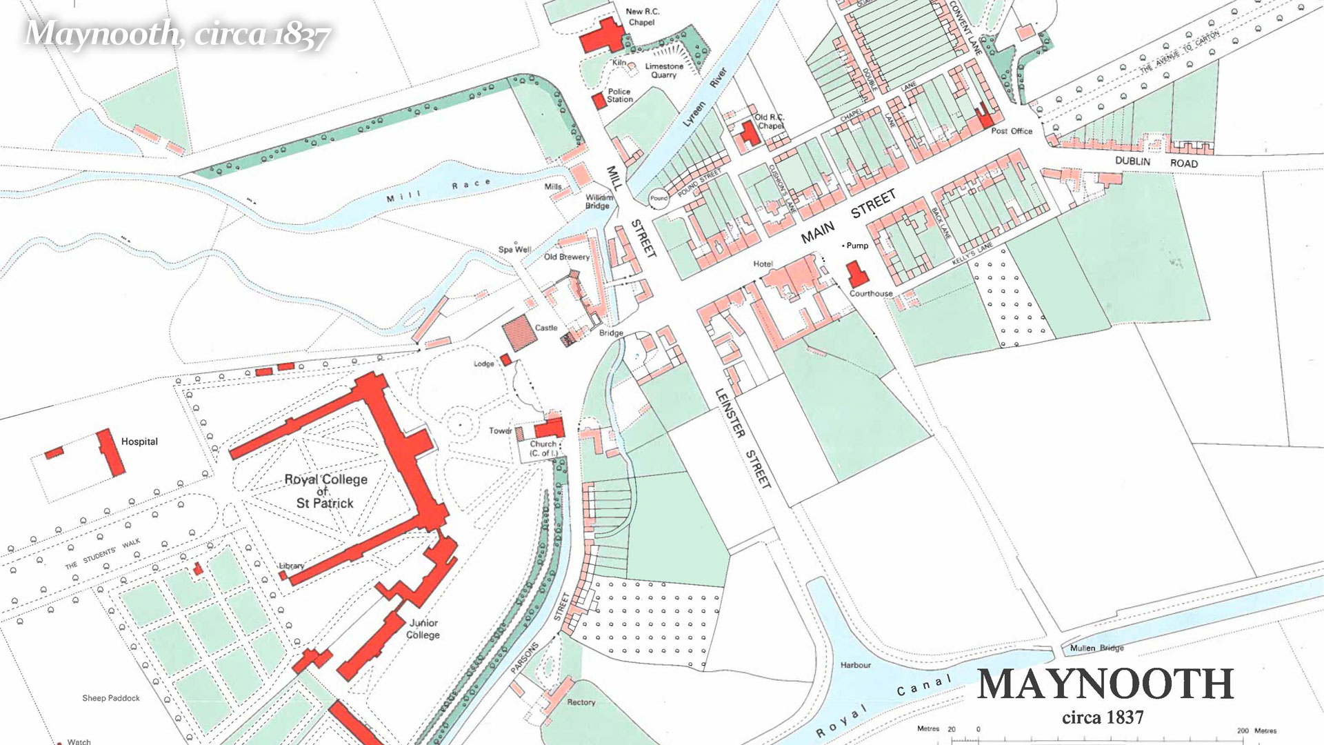
• Much of the centre of the town as we know it today is complete
• Original Leinster Street is now Main Street with the route to the Harbour renamed as Leinster Street
• Post Office on Main Street
• Police Station in Mill Street beside newly built St. Mary’s Church
• St. Patrick’s College site well developed
• Mill and Brewery sites
• However, Railway Station is not on the map as the Railway only came to Maynooth in 1847